How to Find Fish in the Stavanger Fjords
- Espen Haaland
- Mar 6
- 13 min read

Updated: Apr 23
Finding fish in the Stavanger fjords is rarely about luck. Fishing in Stavanger takes place within a complex fjord system shaped by glaciers, steep underwater terrain and shifting coastal currents. Fish gather in specific places within this landscape, and understanding how depth, structure and movement interact is the key to locating them consistently.

For visitors experiencing fjord fishing in Stavanger for the first time, the water can appear deceptively uniform. From the surface, many areas look like wide open water surrounded by mountains and islands. In reality, the seabed below is highly structured, with drop-offs, underwater ridges, basin edges and slopes that strongly influence where fish hold.
Learning how to read this underwater terrain is one of the most important parts of successful fishing in the Stavanger fjords. Depth, structure and positioning often matter far more than simply covering large areas of water.
If you are new to fishing in Stavanger, a broader introduction to the local fjord ecosystem, species and seasonal conditions can be found here: The Ultimate Guide to Fjord Fishing in Stavanger
For visitors interested in experiencing this type of fishing firsthand, you can also explore our private fjord fishing tours in Stavanger, where local knowledge and careful positioning help reveal how fish actually use the fjord’s underwater structure.
Why Fish Gather in Specific Places in Fjords
Fish in the Stavanger fjords rarely spread evenly across the water. Instead, they tend to gather around specific underwater features where several favourable conditions come together. Understanding these locations is one of the most important skills in successful fjord fishing in Stavanger.

In fjord environments, structure shapes how water moves and where food accumulates. Drop-offs, basin edges and underwater ridges often create natural feeding zones because they influence current flow and concentrate baitfish. Small fish, plankton and other prey are frequently pushed toward these areas, creating predictable hunting grounds for larger predators.
Predatory species commonly encountered while fishing in Stavanger fjords - such as cod, pollock and saithe - naturally position themselves close to these transitions.
Cod often hold near the seabed along rocky slopes or basin edges, while pollock may patrol slightly higher in the water column along underwater ridges or steep drop-offs. By holding near structure, these fish conserve energy while remaining perfectly positioned to intercept passing prey.
This is why productive fishing in the Stavanger fjords rarely happens in completely featureless water. Even relatively small changes in seabed terrain can create important habitat. A gentle slope turning into a steeper drop, a ridge rising from a basin, or the edge where shallow water transitions into deeper terrain can all become reliable gathering points for fish.
For anglers exploring fishing in Stavanger, recognising these structural transitions is often the first step toward consistently finding fish. Instead of searching randomly across large areas of water, experienced anglers focus on reading the fjord landscape and identifying the underwater terrain where fish are most likely to hold.
Understanding Fjord Structure
The underwater terrain in the Stavanger fjords is the result of powerful geological forces that shaped the Norwegian coastline thousands of years ago. During the last ice age, massive glaciers slowly carved deep valleys through the landscape as they moved toward the sea. When the ice eventually retreated, these valleys filled with seawater, creating the fjords that define the Stavanger region today.

This glacial history explains why the fjords around Stavanger often contain dramatic underwater terrain. Instead of a flat seabed, the fjord floor typically consists of steep slopes, deep basins and submerged ridges. These features create a highly varied underwater landscape that strongly influences currents, water movement and marine habitat.
Several structural features commonly appear throughout the Stavanger fjords. Steep drop-offs can occur surprisingly close to shore, where shallow coastal areas suddenly descend into deep water. Long underwater slopes often connect these shallower zones with deeper fjord basins, sometimes reaching depths of many tens or even hundreds of meters. In other places, ridges and plateaus rise from the seabed, forming natural underwater landmarks surrounded by deeper terrain.
Basin edges are particularly important because they often guide underwater currents along natural contour lines. Even slow-moving currents can transport plankton and nutrients through the fjord system, helping sustain the food chains that support larger marine species.
For anyone interested in fishing in Stavanger fjords, understanding this underwater landscape is essential. Recognising how slopes, basins and ridges shape the fjord environment makes it far easier to interpret where fish are likely to gather.
How Depth Influences Fish Location
Depth plays a central role in fjord fishing in Stavanger. In the steep fjord systems around Stavanger, the seabed often changes dramatically within short distances. These depth variations create different habitats that influence water temperature, current movement and the distribution of baitfish - all factors that determine where larger fish are likely to be found.

During the warmer months, many species move closer to mid-depth structures where food is abundant. Pollock frequently patrol slopes and underwater ridges, often moving actively through the water column while hunting baitfish. Cod, on the other hand, tend to stay closer to the seabed along rocky transitions, drop-offs and basin edges where they can ambush prey moving along the bottom.
As water temperatures fall later in the year, fish behaviour gradually shifts. In colder months, many species move deeper where temperatures remain more stable and food sources concentrate along deeper terrain. Winter fishing in the Stavanger fjords often takes place between approximately 40 and 100 meters, although the most productive depth can vary depending on current, terrain and local conditions.
For anglers exploring fishing in Stavanger fjords, this means depth should never be treated as a fixed number. Instead, it must be interpreted together with seabed structure, seasonal patterns and daily conditions on the water.
Understanding how depth interacts with structure is one of the key skills in consistently locating fish in the Stavanger fjords.
If you want to explore how fishing depth changes throughout the year, you can read:
For a more detailed explanation of winter conditions:
Using Sonar to Read the Fjord
Modern sonar technology makes it much easier to understand what is happening beneath the surface. In the Stavanger fjords, where productive fishing structure often lies far below the surface, sonar provides essential insight into both underwater terrain and fish activity.
For anglers interested in fishing in Stavanger, sonar helps reveal how depth, seabed structure and fish movement interact throughout the fjord system. Instead of guessing where fish might be located, modern sonar allows anglers to interpret what is happening in real time beneath the boat.

A modern fish finder can reveal several important elements at once:
• depth transitions such as drop-offs and basin edges
• seabed composition and underwater structure
• schools of baitfish moving through the water column
• individual fish or clusters suspended above the seabed
Often the most valuable information comes not from seeing fish directly, but from recognising the terrain where fish are likely to hold. A steep underwater slope, a basin edge or an isolated ridge can create ideal feeding zones even when fish are not immediately visible on the screen.
On a guided fjord fishing trip in Stavanger, sonar and detailed seabed mapping make it possible to interpret these underwater features far more precisely. Modern chartplotters provide highly detailed bathymetric maps of the fjord floor, revealing slopes, ridges and depth transitions that would otherwise remain invisible from the surface.
Learning how to interpret sonar correctly still requires experience. Subtle signals in the water column or along the seabed can indicate fish behaviour that is not immediately obvious.
In practice, this means we rarely begin fishing without first identifying promising structure or fish activity on the sonar. By locating baitfish, depth transitions or individual fish on the screen, the boat can be positioned more precisely over terrain where fish are actually holding. This approach makes it far easier to focus time and effort in areas where fish are genuinely present within the Stavanger fjords.
Seasonal Changes in Fish Location
Fish behaviour in the Stavanger fjords changes throughout the year as water temperature, daylight and the movement of baitfish gradually shift. These seasonal changes influence where fish position themselves within the fjord system, which is why productive fishing locations in Stavanger often vary from month to month.
If you want a more detailed explanation of how seasons affect fjord fishing in Stavanger, you can read: → Best Time and Seasons for Fjord Fishing Around Stavanger

In spring, increasing daylight and rising water temperatures bring more biological activity to the fjords. Small baitfish begin moving into shallower areas, and predatory species such as pollock and cod often follow. During this period, productive fishing in the Stavanger fjords frequently occurs along rocky slopes, reefs and mid-depth structures closer to the coastline.
In summer, the fjords become highly active ecosystems. Large schools of baitfish move through the water column, sometimes spreading fish across multiple depth zones. Pollock may patrol along steep slopes and underwater ridges, while cod often remain closer to the seabed near structure where food passes naturally with the current.
During the warmer months, fishing in the Stavanger fjords often takes place between approximately 20 and 80 meters, depending on terrain and baitfish activity. Productive areas frequently include underwater slopes, ridge systems and basin edges where fish move between feeding zones at different depths.
In autumn, cooling water temperatures often concentrate fish along more defined terrain such as basin edges, underwater ridges and deeper transitions. Many experienced anglers consider this period particularly productive for fishing in Stavanger, as predatory fish feed actively before winter conditions arrive.
During winter, activity usually shifts deeper. Many species move toward stable depth zones where water temperatures fluctuate less. Fishing in the Stavanger fjords during winter often takes place along deeper slopes and basin edges, typically between 40 and 100 meters or deeper, where fish hold close to structure.
These seasonal patterns are one reason why local knowledge becomes valuable when fishing in Stavanger fjords. Understanding how fish respond to changing conditions makes it far easier to identify productive areas and adjust fishing depth and location throughout the year.
Wind direction and tidal movement can also influence where fish position themselves along the fjord structure. → How Weather, Wind and Tides Influence Fjord Fishing in Stavanger
Why Boat Positioning Matters
One of the most common misconceptions about fishing in the Stavanger fjords is that success comes from constantly moving between locations. In reality, productive fishing often depends far more on careful boat positioning than on covering large distances.

Once promising underwater structure has been identified - such as a drop-off, ridge or basin edge - the goal is not simply to fish the area, but to position the boat so that the bait passes naturally through the zone where fish are holding. Even small adjustments in boat position can make a noticeable difference.
In fjord fishing, currents and drift play an important role. As the boat moves slowly with wind and current, the fishing line travels across the seabed terrain below. By adjusting the starting position of the drift, anglers can guide their bait across slopes, basin edges or ridges where fish are most likely to be present.
When particularly productive structure is located, modern boat technology also allows the position to be held precisely. Some boats are equipped with GPS-based positioning systems that can automatically maintain the boat’s location over a specific spot. This makes it possible to remain directly above promising structure without drifting away, allowing anglers to fish a productive area consistently once fish have been located.
Experienced guides spend much of their time refining these positions rather than moving constantly between locations. Holding the correct depth along a structural transition - such as the edge of a basin or the upper part of a slope - can dramatically increase the likelihood of encountering fish.
This approach creates a slower and more deliberate rhythm on the water. Instead of chasing activity across large areas of the fjord, the focus shifts toward understanding how the underwater landscape works and positioning the boat carefully where fish are already likely to gather.
For visitors interested in fishing in Stavanger fjords, this method often makes the difference between randomly fishing open water and working precisely along the underwater terrain where fish naturally hold.
Why Local Knowledge Matters
For visitors unfamiliar with the Stavanger fjord system, locating productive fishing areas can be surprisingly difficult. Much of the underwater terrain that attracts fish lies far below the surface and cannot be recognised visually from the boat.

When fishing in Stavanger fjords, the most productive locations are often defined by subtle underwater features such as basin edges, underwater ridges, slopes and depth transitions. These structures may lie tens of meters below the surface, making them impossible to identify without local knowledge, detailed charts or sonar interpretation.
Local fishing guides spend years learning how specific areas of the Stavanger fjords behave under different conditions. Wind direction, tidal movement, seasonal water temperature and baitfish migration can all influence which structures become productive on a given day.
A location that holds fish during calm summer conditions may behave very differently during winter tides or strong wind-driven currents. Experienced local guides learn how these factors interact and how fish respond to them throughout the year.
Instead of searching randomly across large areas of water, experienced guides fishing in Stavanger can quickly narrow the search to specific structural zones where fish are most likely to gather. From there, boat positioning, depth control and drift adjustments can be refined to present bait directly within the feeding zone.
For visitors exploring fjord fishing in Stavanger for the first time, this local knowledge often transforms the experience. What might otherwise feel like trial-and-error fishing becomes a more focused and rewarding exploration of the fjord landscape.
For travelers who would like to experience this type of structured fjord fishing firsthand, you can explore our private fjord fishing tours in Stavanger, where local knowledge and careful positioning help reveal how fish actually use the underwater terrain.
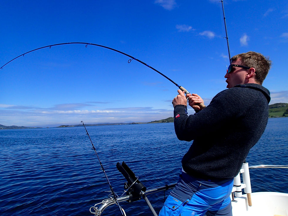
Experiencing Fjord Fishing in Stavanger
For many visitors, fjord fishing in Stavanger becomes one of the most memorable ways to experience the Norwegian coastline. The combination of dramatic fjord scenery, sheltered waters and hands-on fishing creates a day that is both relaxing and engaging.
Unlike offshore fishing, fishing in the Stavanger fjords usually takes place within protected coastal waters surrounded by islands, mountains and narrow fjord passages. This environment allows the experience to unfold at a calm and natural pace, where both the landscape and the fishing become part of the journey.

During a typical private fjord fishing tour in Stavanger, the focus is not simply on dropping a line into open water. Instead, the day revolves around understanding the fjord landscape - locating underwater structure, identifying depth transitions and positioning the boat carefully along productive terrain.
Guests often become part of this process. As the sonar reveals underwater slopes, ridges or basin edges, it becomes easier to understand how fish use the fjord environment. Fishing then becomes less about luck and more about learning how the landscape beneath the water shapes where fish gather.
This approach creates a day that naturally blends exploration, learning and fishing - offering insight into both Norwegian coastal life and the hidden structure of the fjord itself.
If you would like to experience fjord fishing in Stavanger firsthand, you can learn more here:
For a broader overview of species, seasons and fishing conditions in the region, you can also read: → The Ultimate Guide to Fjord Fishing in Stavanger
FAQ: Finding Fish in the Stavanger Fjords
Where do fish usually hold in the Stavanger fjords?
Most fish hold close to underwater structure such as drop-offs, basin edges, ridges and slopes - areas where current and baitfish naturally concentrate.
What depth is best for fjord fishing around Stavanger?
It depends on season and conditions. In summer, fishing often happens around 20–80 meters. In winter, it is commonly 40–100 meters, sometimes deeper.
Do you need sonar to find fish in the fjords?
You can catch fish without sonar, but sonar makes it far more efficient by revealing structure, baitfish and depth transitions in real time.
Why does boat positioning matter so much?
Because small changes in drift line and depth can move your bait into—or out of—the feeding zone along a slope or basin edge.
Do you start fishing even if you don’t see fish on the sonar?
Usually no. We typically locate promising structure and signs of life (bait, edges, marks) first, then position the boat precisely before fishing.
Is fjord fishing in Stavanger good for beginners?
Yes - especially on a private tour. Sheltered water, calm pacing and step-by-step guidance makes it approachable.
What fish can you catch in the Stavanger fjords?
Common species include cod, pollock and saithe, with mackerel in season, plus occasional flatfish depending on depth and conditions.
What time of year is easiest for finding fish?
Late spring to early autumn is often easiest due to longer daylight and more visible activity, but winter can be excellent if you fish deeper structure.
Is it better to fish shallow or deep in the fjords?
Neither is “always best.” Shallow can be technical and structure-focused; deep can be more stable and seasonal. Depth depends on temperature, bait and terrain.
How do I book a private fjord fishing tour in Stavanger?
You can explore the options and request a date through the Stavanger Adventure fishing tours page.
Finding the Right Private Fjord Fishing Tour in Stavanger
Understanding how structure, depth and boat positioning influence fishing in the Stavanger fjords helps explain why some areas consistently hold fish while others remain quiet.

Private fjord fishing tours in Stavanger are shaped around these natural patterns rather than rigid routes. By reading underwater terrain, interpreting sonar and adjusting positioning carefully, each day on the fjord becomes a process of exploration rather than random searching.
If this approach resonates with you, you can explore the available private fjord fishing tours in Stavanger, where each experience focuses on calm pacing, local knowledge and understanding how fish actually use the fjord landscape.
If you’re unsure which option fits your plans, you’re welcome to reach out by email. A short conversation is often the easiest way to shape a calm and personal day on the water.
For a broader understanding of how fjord fishing in Stavanger works - including seasons, species and practical expectations - you can also explore:
Calm. Personal. Real.


Comments